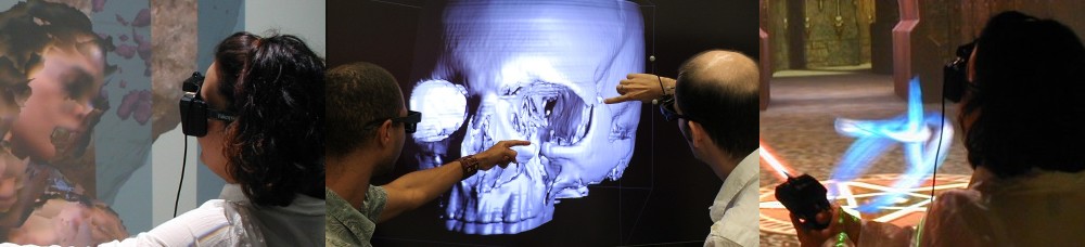
I just found this old photo on one of my cameras, and it’s too good not to share. It shows former master’s student Peter Gold (now in the PhD program at UT Austin) working with a high-resolution aerial LiDAR scan of the El Mayor-Cucapah fault rupture after the April 2010 earthquake (here is the full-resolution picture, for the curious).
Figure 1: Former master’s student Peter Gold in the CAVE, analyzing a high-resolution aerial LiDAR scan of the El Mayor-Cucapah fault rupture.
I thought I did a really good job with the color map, given that that’s not normally my forte. The icy blue — dark blue gradient nicely brings out the fractures in the crust, and the heavy element inclusions stand out prominently in gold (Blue and gold? UC Davis? Get it?). You can watch the full video on YouTube. I’d link to Qing-zhu’s own copy of the video, but it has cooties, I mean ads on it, eww.
And as can be seen in a full-page ad on page 31 of the same issue of Microscopy Today, apparently my picture — no doubt by virtue of the 3D meteorite fragment scan shown in it — was one of the winners in a “coolest thing you’ve never seen” contest held by the company who made the X-ray CT scanner. My little picture is Miss September 2013. Hooray, I guess?
The most interesting aspect of this talk, for me, was that the art project and all the software development for it, are done by the “other” part of the KeckCAVES project, the more mathematically/complex systems-aligned cluster around Jim Crutchfield of UC Davis‘ Complexity Sciences Center and his post-docs and graduate students. In practice, this means that I saw some of the software for the first time, and also heard about some problems the developers ran into that I was completely unaware of. This is interesting because it means that the Vrui VR toolkit, on which all this software is based, is maturing from a private pet project to something that’s actually being used by parties who are not directly collaborating with me.
I’ve recentlyrealized that I should urgently write about LiDAR Viewer, a Vrui-based interactive visualization application for massive-scale LiDAR (Light Detection and Ranging, essentially 3D laser scanning writ large) data.
Figure 1: Photo of a user viewing, and extracting features from, an aerial LiDAR scan of the Cosumnes River area in central California in a CAVE.
I’ve also realized, after going to the ILMF ’13 meeting, that I need to make a new video about LiDAR Viewer, demonstrating the rendering capabilities of the current and upcoming versions. This occurred to me when the movie I showed during my talk had a copyright notice from 2006(!) on it.
Figure 1: Danny Rey, Tribal Historic Preservation Officer, and Marcos Guerrero, Cultural Resources Manager, representatives of the United Auburn Indian Community, viewing a high-resolution 3D scan of the Maidu Historic Trail and Site in the KeckCAVES immersive visualization facility. In the background Joe Dumit of UC Davis’ Science and Technology Studies, and myself. Photo provided by Marshall Millett.
Marshall has been using KeckCAVES software, particularly LiDAR Viewer (about which I should really write a post), and also the KeckCAVES facility itself and related technology, to visualize his high-resolution 3D models at 1:1 scale, and with the ability to experience them in ways that are not normally possible (most of these sites are fragile and/or sacred, and not available to the public). Part of this work were several visits of community representatives to the KeckCAVES facility, to view their digitally reconstructed historic site (see Figure 1).
I just returned from the 2013 International LiDAR Mapping Forum (ILMF ’13), where I gave a talk about LiDAR Viewer (which I haven’t previously written about here, but I really should). ILMF is primarily an event for industry exhibitors and LiDAR users from government agencies or private companies to meet. I only saw one other person from the academic LiDAR community there, and my talk stuck out like a sore thumb, too (see Figure 1).
Figure 1: Snapshot from towards the end of my talk at ILMF ’13, kindly provided by Marshall Millett. My talk was a bit off-topic for the rest of the conference, and at 8:30 in the morning, hopefully explaining the sparse audience.
But let’s back up a bit. When it comes to VR, there are three prevalent opinions:
It’s a dead technology. It had its day in the early nineties, and there hasn’t been anything new since. After all, the CAVE was invented in ’91 and is basically still the same, and head-mounted displays have been around even longer.
It hasn’t been born yet. But maybe if we wait 10 more years, and there are some significant breakthroughs in display and computer technology, it might become interesting or feasible.
It’s fringe technology. Some weirdos keep picking at it, but it hasn’t ever led to anything interesting or useful, and never will.
ShowEarthModel is one of the example programs shipped with the Vrui VR development toolkit. It draws a simple texture-mapped virtual globe, and can be used to visualize global geophysical data sets — specifically those containing subsurface data, as the globe can be drawn transparently. However, ShowEarthModel is not packaged with any data sets, primarily to keep the download size small, but also for licensing reasons. Out of the box, it only contains a fairly low-resolution color-mapped Earth topography texture (which can be changed, but that’s a topic for another post).
Since it’s one of the most common requests, here are the steps to download up-to-date earthquake data from the ANSS online catalog:


